PRINT DETAILS:
Large giclee print on high quality 310gsm Hahnemuhle German Etching paper - a heavy and robust paper that is of archival quality (acid-free), with a velvety matt textured surface, and a warm white hue.
Entire print measures 600 mm × 428 mm (23.6 × 16.8 in) (approx. A2 paper size)
Initial print run of 20, each signed by the artist and numbered.
Prints will be wrapped and rolled up in acid-free tissue paper, and shipped in a sturdy cardboard tube.
Map #5 in my collection.
This wonderfully detailed, hand-drawn map of New York State showcases the states’ major cities, towns and highways from the 21st century together with the estimated regions of Native American territories from the 17th century - along with the locations of various natural landmarks and land formations.
Bordering the main state map are a number of smaller maps - a map of Long Island showing the extent of the the Long Island Railroad System, two city maps in a minimalist style - one of Albany, the state capital and one of New York City, the largest city in the state - and route map following the Hudson River Valley between New York and Albany.
This map took just under 18 months to complete and was incredibly interesting to research, taking me through Native American history, to western colonization and the revolutionary war, all the way to modern day developments and innovations.
This map is perfect for anyone interested in exploring the cities and wilds of New York and delving into its rich history.
(Frame and mount not included)
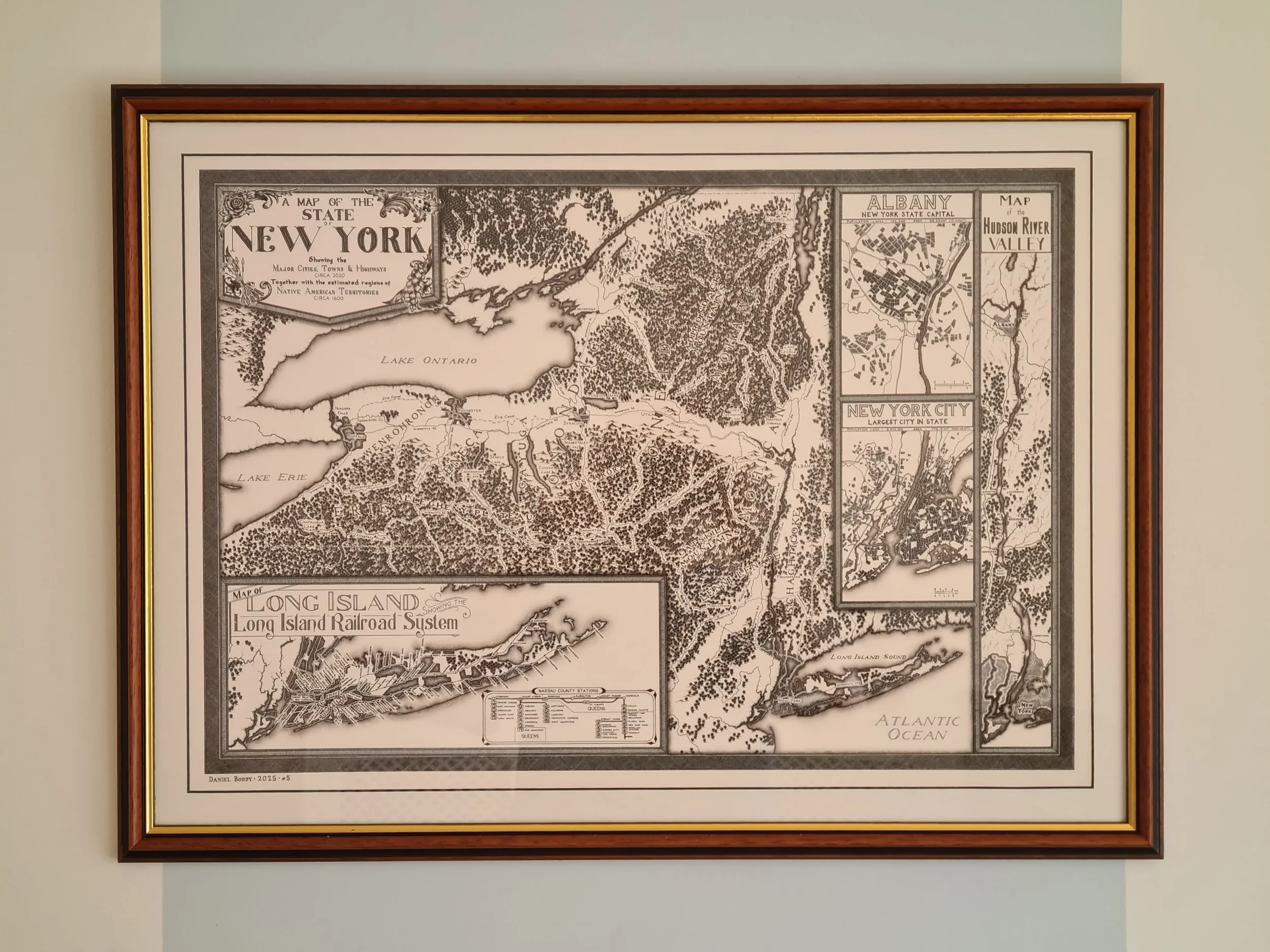 Image 1 of 6
 Image 2 of 6
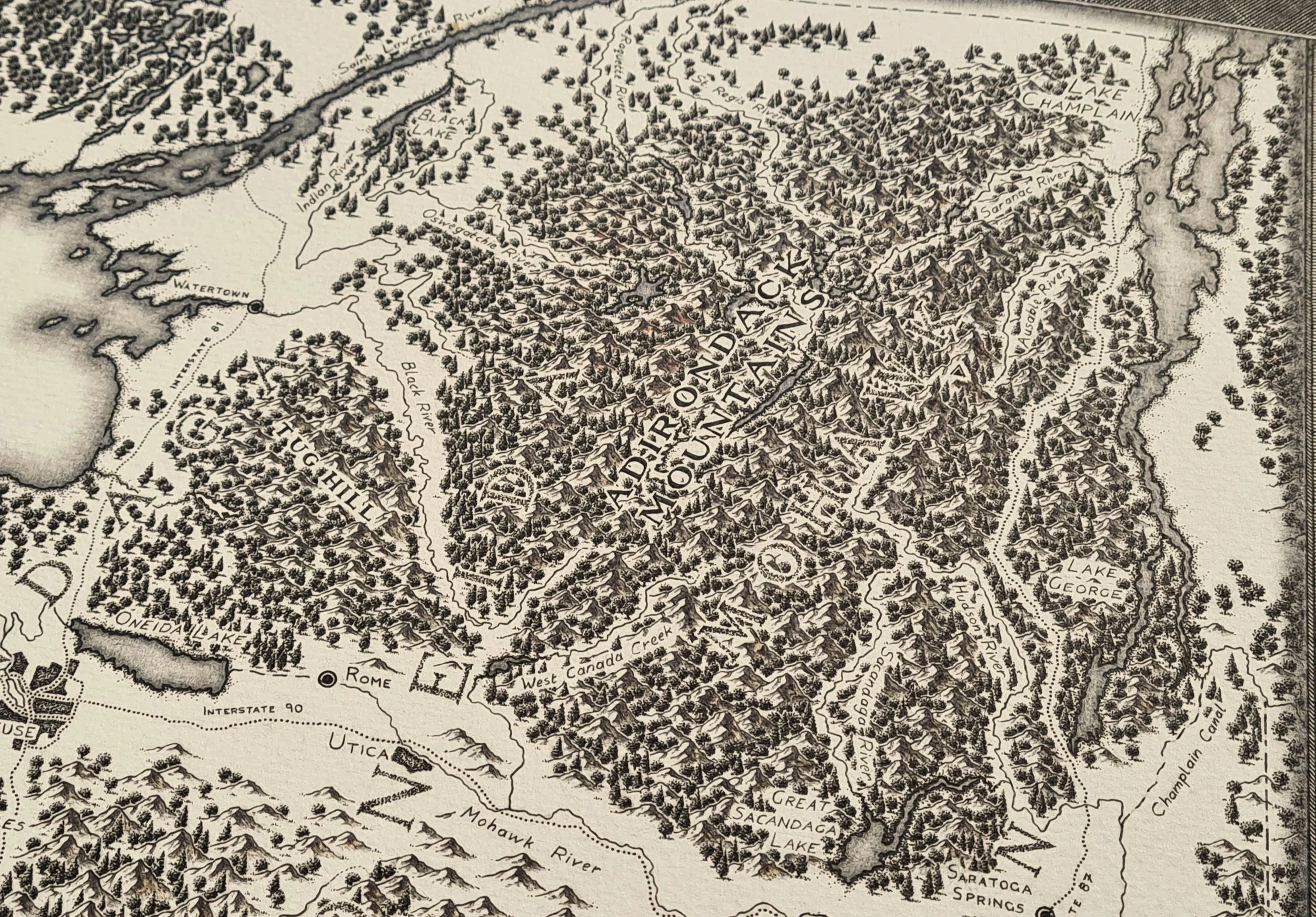 Image 3 of 6
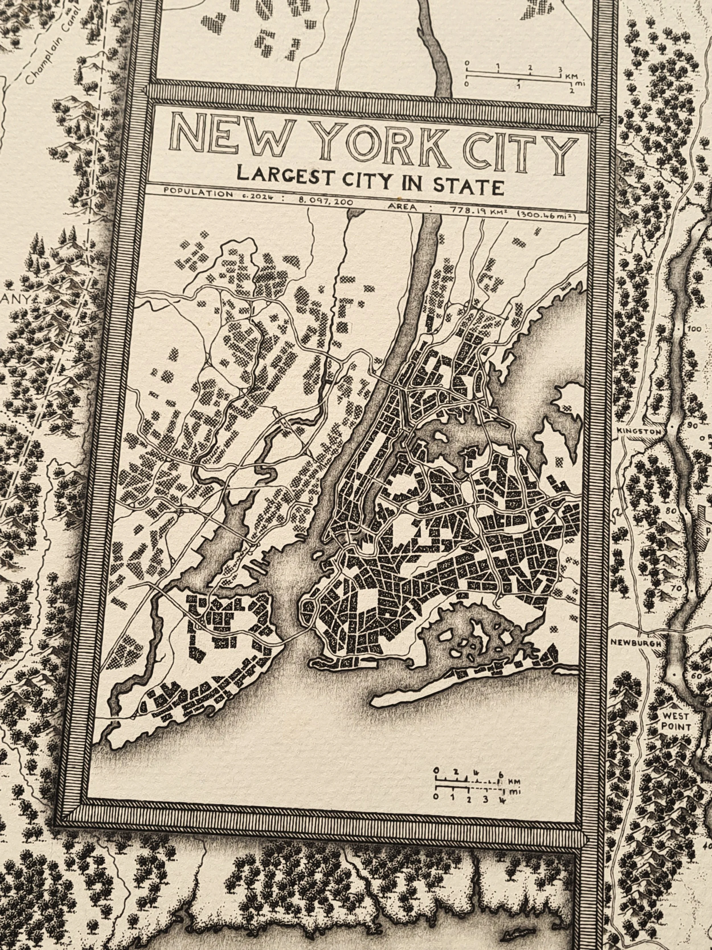 Image 4 of 6
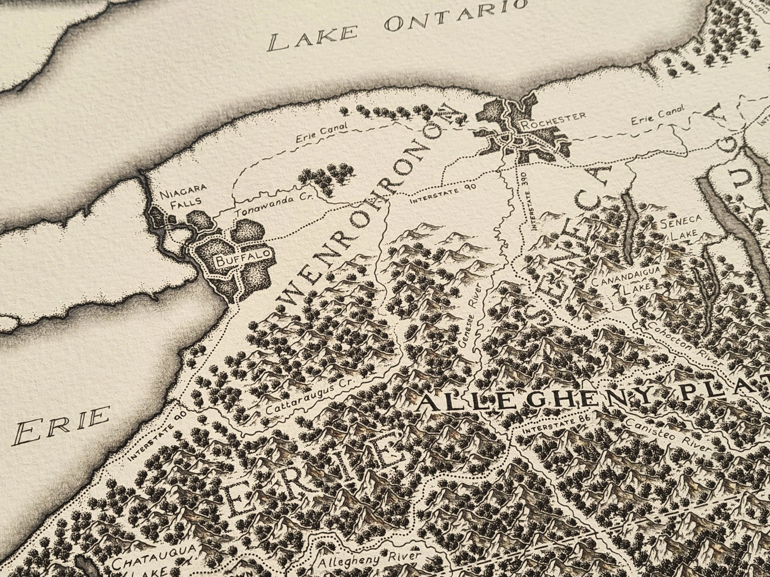 Image 5 of 6
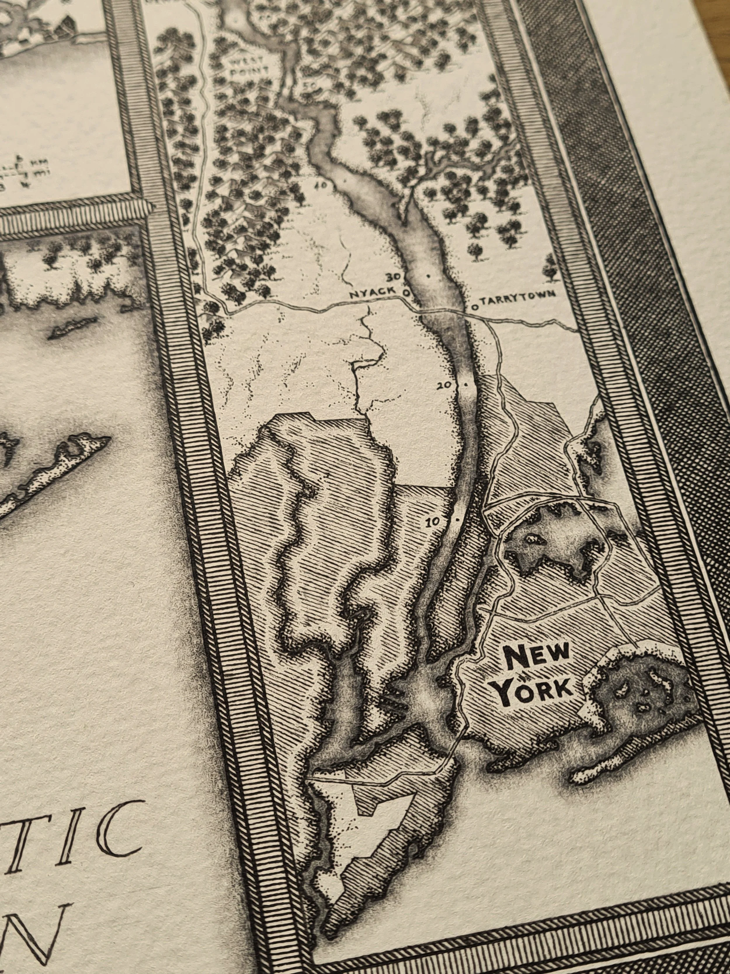 Image 6 of 6